


What treasures are hidden on the Lost Mountain? María García and colleagues wanted to know how effectively plants were protected in the Ordesa and Monte Perdido National Park. They searched SIVIM for plant inventories. This is where a botanist visited a specific spot, recorded every plant species present, and classified the habitat. They also studied historical photos and compared them with modern re-takes to see how these habitats had changed. Combining the two approaches they were able to identify where in the park plants were best protected and where they were most at risk.
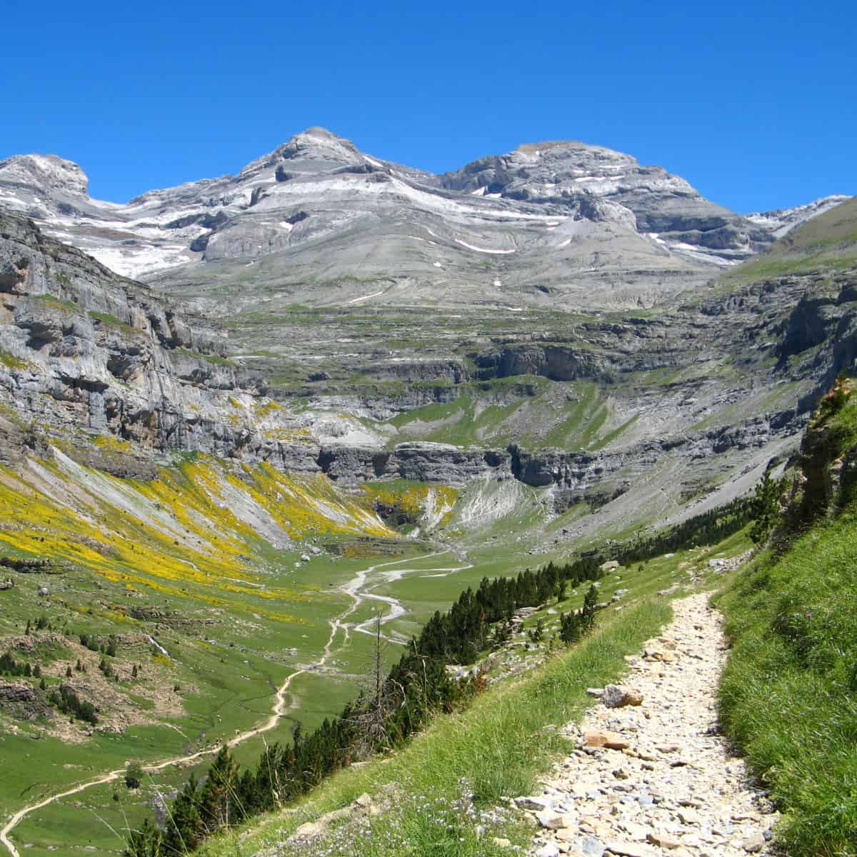
Ordesa and Monte Perdido National Park is one of Europe’s oldest National Parks, and not an easy place to survey. It sits in the Pyrenees, the mountain range that divides France from Spain. The park is part of the wider Pyrénées - Mont Perdu World Heritage Site, which is listed by UNESCO for its spectacular geology. And it’s that geology that makes things difficult.
It’s not just that Monte Perdido has a lot of up, reaching over 3,300 metres above sea level. It has a lot of down too, with valleys plunging to just 650 metres above sea level at their lowest. Ideally, you’d survey this site from the air. But the canyons keep their secrets. Over a quarter of the park is hidden from aerial photography, hidden in cliffs and vertical terrain only visible from the ground.
In this terrain, historical photography can reveal details hidden from the air. The team examined a collection of historical photos with some images over a hundred years old. They then tried to retake some of these photos. But things change over a century and sometimes they couldn’t even reach the original camera points because they had been swallowed by vegetation.
The biggest change has been in the forests. There are a lot more of them. Rural Spain is depopulating, leading to the abandonment of farming. This, in turn, allows trees to colonise what was grassland or shrubland. Yet there are places the trees cannot reach.
García and colleagues found that the cliffs had barely changed at all. These were the most stable land cover over the past century. They also sheltered the highest concentration of endemics and range-edge species. Their inaccessibility makes them ideal refuges for threatened plants. This correlates with observations made about cliffs as conservation hotspots.
The research shows that ‘protection’ might not be enough for all the park’s plants. Forest expansion is squeezing the open habitats where many threatened and endemic species live. The historical photography has been a crucial element in understanding this process, and how conservation work needs to change.
They argue that the public is an essential partner in this work. They conclude: “Citizen science initiatives, such as the one utilised in this study, can contribute significantly to the monitoring and conservation of cliffs, given their aesthetic appeal. The integration of public engagement would facilitate not only the collection of data but also raise awareness of the existence of refugia and their transcendental role for biodiversity in a transforming world.”
READ THE ARTICLE
García, M., Díaz-Gil, C., Aparicio, E., Quintana-Buil, M., Pizarro, M., Gómez, D., and Font, X. (2025) Historical imagery reveals cliffs as refugia for biodiversity in steep mountains. Global Ecology and Conservation, 64, pp. e03965. Available at: https://doi.org/10.1016/j.gecco.2025.e03965.
Cover image: Monte Perdido in the Ordesa Valley by Patrick Rouzet, CC BY-SA 3.0, via Wikimedia Commons

