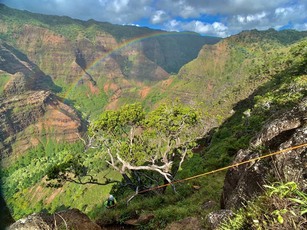

In 2019, drone footage went viral with the headline “Extinct flower rediscovered in Hawaii, via drones”. Scientists at the National Tropical Botanical Garden (NTBG) in Kaua’i were flying drones alongside impenetrable cliffs and spotted a plant, Hibiscadelphus woodii, that was declared extinct in 2016.
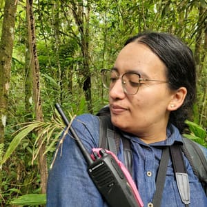
In celebration of Fascination of Plants Day, we are following up the story with Ben Nyberg, the GIS and Drone Program Coordinator at NTBG. Nyberg was using drones for creating maps in his personal business before deploying them at NTBG in 2016.
“Pretty quickly, I realised that there are all these cliff environments around and even within our gardens, could be looked at [with drones]”, Nyberg says.
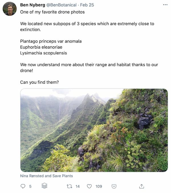
At the beginning of the drone program, NTBG surveyed the 1,000-acre Limahuli preserve, and the team spotted the critically endangered Laukahi plant on extremely steep cliffs. Only 25 plants were known to grow in Hawaii before that sighting, and ten more plants were added to the list after a single drone flight.
“With a few flights, we were able to identify populations of rare plant species, literally 1,000 meters from our visitors centre that we never knew were there before.”
Everyone became excited. NTBG purchased more drones and kept the momentum going. Mapping plant populations helped them understand each species habitat preferences and come up with conservation plans.
Whilst flying around drones and spotting plants sounds somewhat straightforward, but there is more to it. First, the team scouts an area with spotting scopes and finds the best spots to fly the drone.
“I move the drone in, as close to as I can, around 2-5 m to the surface, and snap a still photo. This is done systematically around an area. Then back in the lab, I manually look through each photo. I use Adobe Lightroom and I identify each plant one-by-one. The data is then transferred to GIS software for mapping.”
The technology (both drones and software) is constantly evolving, and Nyberg has to stay on top of it. Lately, they have been trying out drones with zoom lenses, but one of the main problems is getting GPS information near cliffs and image processing.
“We are looking at artificial intelligence and machine learning to pick out these plants but we have so many rare species that they do not have good, reliable training data.”
They need to be absolutely certain about their identification when they come across a species that has been thought to be extinct.
“For now, it looks like it takes a human brain to tell them apart.”
Not everything goes to plan all the time, either. They have lost two drones since starting the program. One might have either malfunctioned or got knocked down by a bird strike. The other one was due to an incorrect automation system where the drone crashed into a tree.
But Nyberg highlights, “it’s much better to lose a drone than a person. It is a minor inconvenience.”

He has collaborators all around the world and works on a myriad of projects. NTBG took the lead in checking the conservation status of over 250 endemic plant species around Kaua’i for IUCN. There are a few more species on his to-do list this week. He is working with the DeLeaves team, trying to add a sampling arm to drones to grab samples from hard-to-reach plants.
He is also working on using drones for reseeding areas and a month ago started a PhD at the University of Copenhagen. He will be looking at the system they have developed in Hawaii, from GIS, modelling hotspots, and then checking them with drones and testing if these tools work in other parts of the world.
Watch Ben Nyberg recent presentation on using drones to spot and study the critically-endangered Lysimachia scopulensisin Hawaii.
Local initiatives can be highly efficient and are much needed. Scaling up these efforts and combining them can reveal more stories about plants, ecosystems and humans’ impact on the natural world.
He highlights Greg Asner’s work (watch his TedTalk) on the Airborne Taxonomic Mapping System that can create high-resolution 3D maps from forests to coral reefs. Another reforestation-by-drone initiative is Dronecoria, where a team of scientists have come up with an open-access software and drone design that can drop half a million soil-coated seeds in a 10-minute flight. There are indeed many exciting and innovative conservation projects all around the world using drones and satellites.
This year is also the beginning of the UN Decade on Ecosystem Restoration. This initiative aims to “build a strong, broad-based global movement to ramp up restoration and put the world on track for a sustainable future”. Whilst people are the driving forces behind all these conservation and restoration efforts, drones, remote sensing and digital tools (check out Restor!) offer a helping hand.
Whilst drones tend to have a bad reputation, and Nyberg does not like someone flying drones above him on a beach either, NTBG does a lot of outreach, so visitors and locals understand why drones are an excellent tool for plant conservation. Their drones are also flown in areas where there aren’t any people around. They only have to be mindful of tourist-carrying helicopters.
“With COVID, there wasn’t any tourism in Hawaii so it was very nice and quiet in the skies but now, tourism is picking up again.”
To wrap up the interview, I asked Nyberg where his fascination with plants has come from.
“It’s just really cool to learn about all these plants,” he says. “I think island biogeography is just so interesting. To think of Hawaii as these bare rocks in the middle of the Pacific, that were then colonized over long distances, and the range of plants that have now evolved here, it’s really mind blowing.”
“So many visitors come to Hawaii but may not fully experience that connection with this special environment. They see the palm trees and beaches but when they look at the cliffs, I do not know if they realise how amazing this place is.”
His grandfather had a farm and tree nursery. He was always surrounded by plants and loved hiking and camping, but he did not have this “special connection” until he started working at NTBG. His fascination with island flora blossomed there.
“Now I am a lifelong plant enthusiast! And I hope it rubs off on people just as I talk to people about what I do. The cool part of the drone is the beautiful imagery, it can capture people’s interest and then, we can tell the interesting stories of plants.”
Fascination of Plants Day is not just to celebrate plants but also the people who study them.
Make sure you follow him on Twitter, and if you cannot pop over to Hawaii to visit NTBG’s gardens, keep your eyes out for virtual events.