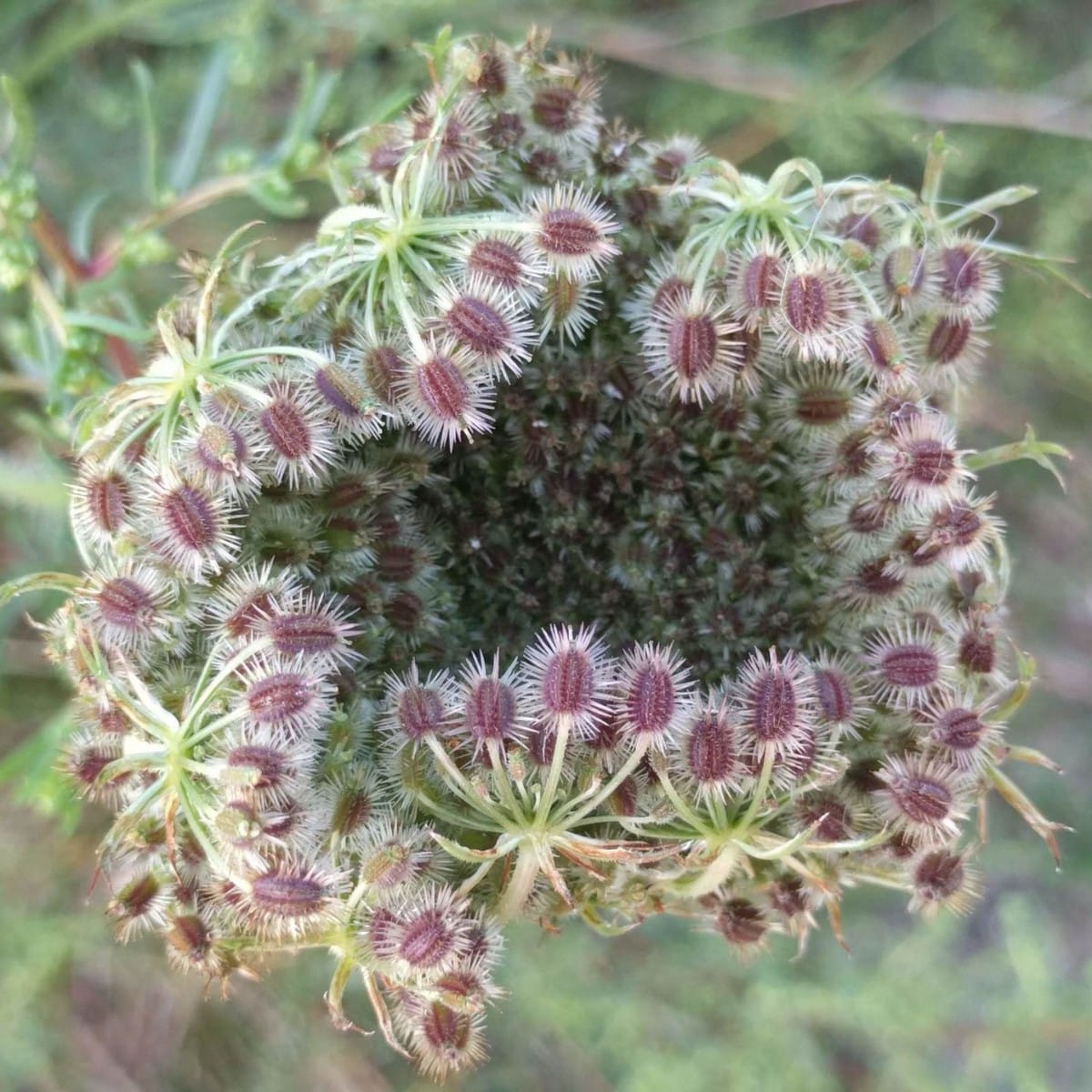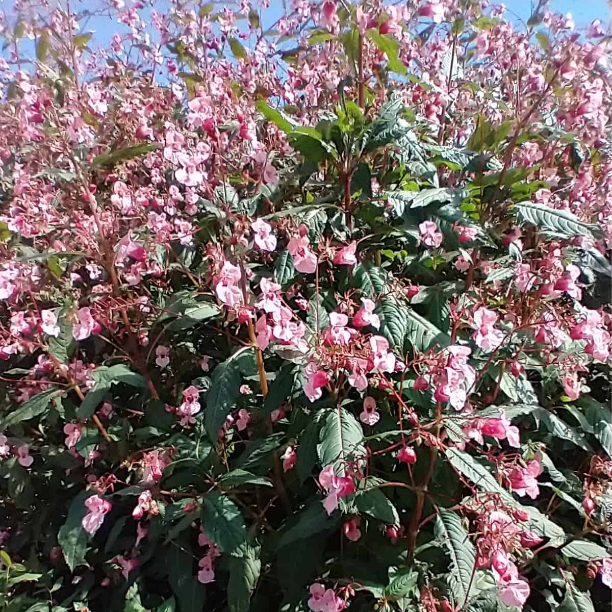


A study in the United Kingdom has shown that drones can be used to identify and map the invasive species Impatiens glandulifera (Himalayan Balsam) along riverways. The advance allows for easy tracking of this noxious weed in a habitat that has historically been difficult to access. In the recent paper, published by Ecology and Evolution, scientists determined the locations of Himalayan Balsam by imaging flowers along the River Elwy in North Wales. The invasion hotspots can now be targeted for management.
“Himalayan Balsam aggressively covers large areas, creating monotypic stands that outcompete other species,” write Cook et al, who advise that “invasive species management is most cost-effective if applied as an early intervention in comparison to post-invasion, long-term management.”
Unfortunately, Himalayan Balsam lives along riverways in habitats called riparian zones, which are hard to monitor because of their topology. These habitats sit at the interface between terrestrial and aquatic systems, making it physically difficult for human surveyors to enter. Additionally, dense canopy coverage makes overhead satellite imagery a challenge. As a result, an alternative approach to monitoring is needed.
Consequently, Cook et al explored the use of unmanned aerial vehicles (UAVs), commonly known as drones, to survey for Himalayan Balsam. Previous studies for other species had already shown promise and demonstrated that UAVs have many advantages. They can be flown at different times of year, and image resolutions can be easily adjusted to optimise data collection.
“The [UAV] approach enables imagery to be captured at optimal times of the year when the invasive species are within key phenological stages that make them easier to identify, for example, flowering,” write Cook et al. “The flexibility of UAV surveys also enables understory imagery to be collected from an oblique angle, avoiding canopy obstructions which may occur along riparian corridors.”
Cook et al were able to fly their UAV at a ~5 m distance from the riverbank at an altitude of ~2 m above ground level. They captured images of the plants at a ~45-degree “side-facing” angle and used Hue, Saturation, and Value colour space parameters to automate detection of Himalayan Balsam flowers for species identification. Automation produced reasonably high levels of precision, correctly identifying 72%-86% of the Himalayan Balsam flowers.
“The semi-autonomous method facilitates rapid assessments of objects/flowers detected within UAV imagery, indicating the number of seeds and potential future plant spread. User-friendly, tunable processing steps allow easy and efficient analysis iterations,” write Cook et al.
Implementation of this automated detection system will be useful in invasive weed management.
The United Kingdom already spends more that £1.7 billion annually on the control of invasive non-native species, which threaten biodiversity and disrupt ecosystem functions and services necessary for humans.
And the problem is only getting worse. Global trade and travel spreads seeds across borders and climate change is altering the habitat range of species so that they move into new locations. Additionally, human activities can modify habitats in ways that foster invasive species growth.
“Invasive species are the cause of numerous impacts, including native fauna decline, local flora extinction, as well as hydrological, fire regime, and soil chemistry alterations,” write Cook et al.
More than 130 invasive species are currently being monitored along freshwater networks in the United Kingdom. And now with drone technology, Himalayan Balsam can be more effectively managed.
READ THE ARTICLE
Cook, J., Roberts, B.P., Labrosse, F. and Snooke, N. (2025) “Detecting and mapping invasive species across riparian corridors via object detection approaches in UAV imagery: An example of Impatiens glandulifera,” Ecology and Evolution, 15(8), p. e71921. Available at: https://doi.org/10.1002/ece3.71921
Cover image: Impatiens glandulifera by Tom Norton / iNaturalist. CC-BY